Will Distance Finally Matter with VMT? By: Crystal Howard

Senate Bill 743 requires CEQA traffic impacts to be measured by Vehicle Miles Traveled (VMT) instead of the traditional Level of Service (LOS) method.  The objective of the legislation is to assist in reducing greenhouse gas (GHG) emissions.  July 1, 2020, marks the deadline for statewide implementation of the new metric and lead agencies are required to adopt guidelines for conducting transportation impact analysis by this date.  To assist with developing the guidelines, the Office of Planning and Research (OPR) published a Technical Advisory in December 2018[1].  The advisory predominantly focuses on residential and commercial office/retail developments and recommends a 15% VMT reduction from regional average VMT per capita for residential projects and regional average VMT per employee for commercial projects. Anything less than this level of reduction may result in a significant impact.  However, OPR guidance does not address how to analyze VMT for industrial projects like construction aggregate quarries.  To overcome this gap in the guidance, this article provides an example of an approach that has been accepted by a lead agency within California.

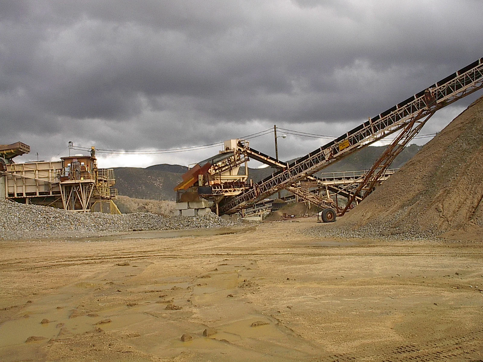
This particular lead agency has a total of 3 proposed construction aggregate projects at various stages in the entitlement process and all are required to address VMT.  With the OPR Technical Advisory silent on how to evaluate VMT for an industrial project like a quarry, the lead agency initially suggested using a screening threshold of VMT per employee, which applies more to office or commercial development projects.  Recognizing that applying a metric for offices did not fit a land-use type like a quarry, EnviroMINE, with the assistance of traffic experts from Linscott, Law and Greenspan Engineers and legal experts from Sheppard Mullin Richter & Hampton developed a methodology for evaluating VMT impacts that would address unique land uses. 

701.jpg

The approach utilized the combination of retail and other project types described in OPR’s Technical Advisory.  For instance, the advisory suggests analyzing the total change in VMT because a new retail project usually re-routes travel from other retail destinations.  Further, a retail project would lead to decreases in VMT because new retail development typically redistributes shopping trips rather than creating new trips.  This is also true for quarries.  Permitting a new quarry does not create demand for construction aggregate, it responds to existing demand.  Therefore, a new quarry that is closer to the source of demand would redistribute existing traffic patterns from quarries; some located at greater distances to the markets they serve.  Additionally, the OPR advisory encourages lead agencies to account for the full trip even if it extends into another City or County.  In other words, the lead agency needs to estimate the full extent of vehicle travel from a project and should use project-specific information, such as market studies or economic impacts analyses to support the conclusion relating to the change in total VMT.  This is advantageous to the construction aggregates industry where material shortages have required importing material from sources located in neighboring counties and often countries.

Our proposed approach included the net distribution of construction aggregate throughout the region with and without the project.  Upon receiving our team’s proposed approach, the lead agency agreed that a change in total VMT was a more appropriate method to use for quarries.  They emphasized that providing a construction aggregate market study with compelling and convincing data was key to the analysis.  The study needed to clearly and defensibly provide an explanation of how the proposed project would provide materials similar to those provided from existing sources.  For instance, one of the proposed projects is a sand operation.  Within the region there is substantial evidence of a significant shortage of permitted sites that supply this material from within the lead agency’s land-use jurisdiction.  As a result, resources from neighboring jurisdictions are relied upon to supply the material to satisfy demand.  The approach for measuring the change in net VMT had to answer the following questions:  How much is imported,  how much is coming from existing sources, and how will the proposed project change the distance the material is transported? 

Within this same lead agency there is also a proposed rock quarry in the permitting process.  With several other permitted rock quarries within the lead agency’s jurisdiction, estimating the total VMT became less obvious.  Using established assumptions for estimating construction aggregate demand, combined with the knowledge of construction aggregate distribution economics, a compelling argument for addressing total VMT reductions was developed.

50.jpg

In both cases the proposed strategy was able to estimate more than a 50% decrease in total VMT, which confirms a significant reduction in GHG by permitting local sources.  Overall, working with the lead agency to evaluate the change in total VMT was essential in telling the story that Distance Does Matter when permitting construction aggregate resources. 

As each jurisdiction develops its guidelines for the evaluation of VMT for quarry projects, it will be important to be proactive in creating a methodology that will work for the construction aggregates industry.  Public agencies have always had broad discretion to set project-specific thresholds based on unique circumstances.  The CEQA Guidelines on VMT reinforce that the state is giving lead agencies the discretion in the analysis of VMT impacts.  The approach used in the example presented in this article included substantial evidence to evaluate the net annual VMT reduction by permitting a source closer to demand.  This same approach could be used in all areas of the state.

How is your lead agency determining VMT thresholds for quarry projects?  EnviroMINE, Inc. will be hosting a free Panel Discussion on Zoom May 15th from 10 – 11 a.m. to offer guidance in the preparation of VMT analysis for the construction aggregates industry.  The Panel Discussion will consist of EnviroMINE, traffic experts from Linscott, Law and Greenspan Engineers as well as legal experts from Sheppard Mullin Richter & Hampton.  To register, please click here or contact Crystal@enviromineinc.com

[1] http://opr.ca.gov/docs/20190122-743_Technical_Advisory.pdf

Mineral Resource Development – SMARA’s Forgotten Promise to the Industry

Mineral Resource Development – SMARA’s Forgotten Promise to the Industry
By: Warren Coalson

About 2 years back, I wrote a letter to the Director of the Department of Conservation complaining about the unequal enforcement of SMARA, noting that while the regulatory functions have been vigorously supported and are highly effective, mineral resource conservation has been all but forgotten.  My letter asks for increased efforts to ensure continued access to the State’s aggregate resources and questions the benefit of the current mapping and classification effort because it does not encourage or facilitate access to classified resources; in fact, the opposite is true. 

As an example, we are involved in two permitting efforts on lands classified as MRZ-2a, resources of demonstrated economic value.  Both projects are highly controversial and are being challenged by community activist groups.  The permitting process includes a detailed CEQA evaluation for both sites which evaluates a full suite of environmental subjects, including consideration for impacts to mineral resource availability. 

The lead agency has developed a guideline for the consideration of impacts to mineral resources.  This guideline is intended to evaluate a development project’s potential to eliminate access to areas of identified resources or to have a negative impact on the ongoing activities of a resource development site (e.g., quarry).  The guideline also requires a finding of significance where a reduction in access to the resource would occur.  Taken to the extreme, a significant unmitigable impact would occur if 100% of the classified resource is not extracted.  Any project with the potential for significant unmitigated impacts, cannot be approved unless overriding socioeconomic findings are adopted. 

Such is the case for our two sand projects.  The lead agency has determined that the projects will have a significant unmitigated impact to mineral resources because they do not recover all of the in-place resources.  This results in the need to prepare overriding CEQA findings and gives the approval body another reason to deny approval.  However, to enable full recovery of the resources, multiple significant impacts to other areas of environmental concern would be realized.  These projects seek to strike a balance between resource recovery and impacts to other sensitive values (e.g., biological resources, aesthetics, flood control, etc.). 

With one minor exception, all sand resources consumed within the lead agency jurisdiction are imported from distant production sites and results in significant vehicle miles traveled to support construction material needs.  If materials can be mined from local sources, the transportation requirement can be significantly reduced.  Although I’m not trying to make an argument for reduced greenhouse gas emissions, the point is obvious.  Providing for locally produced resources would result in reductions to greenhouse gas emissions, wear and tear on roadways and material costs.  It would also provide well-paying jobs for local residents.

The Department of Conservation has a responsibility to ensure wise use of our mineral resources.  As the agency with responsibility for oversight and guidance of SMARA requirements, it is important that all of SMARA’s promises are implemented.  Obtaining a permit for any type of mining project is a difficult undertaking.  Instead of focusing on resource mapping, providing encouragement for locally produced resources would be a better use of time and would actually address SMARA’s promise to the industry – ensuring access to mineral resources (SMARA §2712(b).  It makes absolutely no sense to truck materials over extended distances when those resources are available locally.  The current policy of mapping resources has no value and should be discontinued unless additional steps are implemented to ensure access to these resources.

Where does the opportunity lie?

In California, securing the entitlements for conducting any type of mining operation has become a highly risky and expensive enterprise. Although mining industry wages are among the highest, and the products are one of the most commonly-consumed economic commodities, public antagonism and uncertain entitlement processes are thwarting opportunities to replace depleted resource production facilities. While California seeks to lead the world in Greenhouse Gas Reduction in the fight to forestall environmental calamities, public activism and daunting regulatory processes continue to push production sites farther and farther from the markets they serve.

Perhaps we’re approaching this from the wrong perspective. Could there be opportunities that we can take advantage of where the permitting process can be avoided? Maybe the answer can be found by looking backwards.

Permitting processes can sometimes be reduced by finding past mining properties with important mineral resources that, for one reason or another, have not been active for many years. Establishing a record of land use and ownership’s intent to someday continue mining, and then gaining acceptance of these facts by the local lead agency, may be all that is necessary to avoid a lengthy, expensive and risky permitting process.

About 5 years ago, EnviroMINE, Inc. was approached by the owner of a 430-acre property that had been acquired by their family in 1923 as a Patented Mining Claim. The owner’s interest was to sell or lease the property to a mining company and hoped we could help them find a buyer. The geologic resources at the property included high-purity limestone and dolomite with schist on the fringes. The property was mined between 1923 and 1966. The county’s first zoning ordinance that required a permit for mining was adopted in 1951. Because operations had been conducted prior to zoning restrictions, the mining use became non-conforming, or vested.

Mining operations ended in 1966 when the railroad demolished the processing plant without the owner’s authorization with an intention of placing a rail spur through the property. A subsequent lawsuit ended the encroachment, but resulted in the cancelation of a deal to lease the property to an operating company.

In the years following, the property owners attempted to find a new operator, and in this interest, completed a number of mineral resource evaluations. The resource evaluations identified that as much as 268,000,000 tons of high quality limestone and dolomite were available on the property. Several potential operating companies looked seriously at the site, but despite the abundance and quality of the minerals, permitting requirements were found to be a serious impediment to re-opening the mine on the property.

Because the property was mined continuously for more than 40 years, and the owners never indicated any intent to abandon mining, we believed the property had a vested mining right. This question was raised with San Bernardino County Land Use staff and the immediate response was: There is insufficient evidence to support a vested rights determination. County staff couldn’t support the suggestion, but said that the County might consider it if we were to include this request as part of an application for a Reclamation Plan. Such a request would need to be accompanied by a mine plan and reclamation plan with extensive CEQA analyses and mitigation for a variety of newly-identified impacts included within the plan. Our response was: “You’re crazy.” An operator has not been identified and development of a plan that would address an unknown operator’s needs would be conjecture at best.

Over the next few months, we revisited this subject a number of times; however, the County did not have a procedure in place for considering the determination of vested mining rights outside of a normal permitting process. This was discussed at length with County staff and finally, our persistence resulted in direction to file an application for a General Plan and Development Code Interpretation. Questions relating to code interpretations are typically directed to the Planning Director for a determination, but pursuant to Calvert vs. Yuba County, the determination must be made by a legislative body at a noticed public hearing. Because the Planning Director was prohibited from fulfilling this requirement, the determination was directed to the Planning Commission for consideration.

A detailed application outlining the history of ownership was prepared identifying the nature and duration of the mining operations, subsequent efforts to continue mining and a statement that the intention to continue mining had never been abandoned. This information was submitted it to the County in late October 2018. County staff evaluated the application and prepared a staff report recommending denial of the request. The staff report did not argue the facts relating to the history of use, and based its recommendation for denial on an argument that the use had been “dormant” for more than 50 years.

With less than a week to respond to the staff report, a response was prepared to carefully explain the legal basis for vested mining rights and reasons why we believed the Staff recommendation was in error.

After 3-1/2 hours of deliberation, the Planning Commission voted to support the vested rights determination.

Since this successful determination was adopted, a number of potential buyers have stepped forward and are evaluating the historic mine site. We hope to report the sale of the property in the near future. While it will still be necessary to gain approval for a Reclamation Plan, the process is much simpler and more certain than establishing a mine permit or land use entitlement. CEQA analysis is required, but the impact evaluation will be limited to the activities involved in site reclamation – after mining has been completed.

The take-home here is that if you are looking for a site to conduct mining operations, it may be beneficial to evaluate sites that have been mined in the past, but for one reason or another, are no longer active. The basic questions related to this evaluation are: Was the site being mined before zoning restriction was established; and, did the operator (owner) maintain an intention to mine in the future?

EnviroMINE is aware of a number of mine sites where historic operations were conducted prior to the adoption of zoning restrictions and the lead agency required the issuance of a permit to respect these new requirements. While a claim for vested mining rights should have been defended, many operator’s and land use agencies alike had little knowledge of principles relating to the subject; the simplest way to meet current zoning requirements was to get a permit. Now, in most cases, the entitlements are restricted to set time periods. This may place the operator in the position of having to request permit extension at a later date. For these cases, it may not be too late. EnviroMINE has received vested mining rights recognition for a number of mine sites with existing Conditional Use Permits, thus eliminating the permit requirement altogether.

If you are looking for a site to conduct mining operations, it may be beneficial to evaluate sites that have been mined in the past with remaining resources, but for one reason or another, are not actively being developed today.

New General Waste Discharge Requirements for inert Waste Disposal Facilities

By: Dennis Fransway

New General Waste Discharge Requirements for Inert Waste Disposal Facilities Within the Santa Ana Region Affecting Inert Debris Type A Disposal Facilities (Type A Site) and Inert Debris Engineered Fill Operations (IDEFO)

Mine operators whose site also functions as an inert waste disposal facility (IWDFs), specifically and Inert Debris Type A Disposal Facility (Type A Site) or an Inert Debris Engineered Fill Operations (IDEFO) should be aware of Order No. R8-2019-0008 adopted by the Santa Ana Regional Water Quality Control Board on March 22, 2019. Under this Order, authorizations under a general waiver of, or individual, waste discharge requirements for IWDFs in the Santa Ana Region are rescinded and the new general Waste Discharge Requirements (WDRs) applied. These requirements will not affect Construction & Demolition Waste and Inert Debris Facilities (CDI Waste Disposal Facility) operate under CalRecycle Permits and corresponding Regional Boards WDRs.

Operators proposing to discharge inert wastes must submit a Notice of Intent (NOI) along with a Technical Report described by the general WDRs. Information required in the Technical Report shall include information for the general operation, site physical condition, working and operational design, site operations and monitoring, and waste acceptance procedures. Also, to be included is information on site closure, a compliance schedule for existing facilities and attachments for any optional operations. Proposed compliance schedules for implementation of the identified collection, control, and monitoring practices must ensure compliance as soon as practicable and supported with appropriate technical or economic justification. In no case may the schedule exceed two years from the date of the NOI.

The Order establishes standards for a Monitoring and Reporting Program that requires dischargers to perform regular monitoring and reporting of waste acceptance, management, and disposal activities, and to document performance and completion of necessary site monitoring, management, and maintenance activities plus fees. Reporting will be on an established schedule to include a one time reporting of the NOI and Technical report, an annual report with 28 days of the new year and Storm Event Report within 30 days after the end of a major storm event.

In summary, these new WDRs represent a significant change for the affected IWDFs and particularly for those sites authorized under a general waiver of waste discharge requirements. If your local regional board has not implemented a similar Order, an IWDF operator may want to spend some time becoming familiar with the Santa Ana Board’s Order No. R8-2019-0008 and get prepared. It is expected that other Regional Board’s will follow with a similar Order in the future.

The Santa Ana Region Staff Report and complete Order can be reviewed and downloaded at the following link:

https://www.waterboards.ca.gov/water_issues/programs/cwa401/docs/certifications/order.pdf

AB 901 Recycling and Disposal Reporting

By Kristen Davis

In March 2019, the California Department of Resources Recycling and Recovery (CalRecycle) adopted the recycling and disposal reporting regulations mandated by Assembly Bill 901, which was passed in 2015. The new regulations will require reporting entities to submit information directly to CalRecycle on the types, quantities, and destinations of materials that are disposed of, recycled, processed, or transferred inside or outside of the state.

CalRecycle’s objective is to get a better understanding of the movement of recycled and disposed of material within the State’s infrastructure. Reporting entities will be submitting information directly to the State versus to the local lead agencies, who then submit to the State. Unlike the current reporting system where only disposal facilities report, recycling facilities are now included in reporting.

Timeline

All reporting entities were originally required to complete Recycling and Disposal Reporting System (RDRS) registration by April 30, 2019. However, because of confusion over the requirements for reporting entities, in an email notice dated April 25, 2019, CalRecycle stated they will not be taking any action against reporting entities who have not registered by the April 30th deadline, but will expect all reporting entities to register by May 31st.

Record-keeping pursuant to the AB 901 regulations will commence July 1, 2019 for the 3rd quarter 2019.

The RDRS will open for report submittals for the 3rd quarter on October 1, 2019.

Reports for all reporting entities for the first reporting period of the 3rd quarter must be submitted by December 31, 2019. The specific due dates are different for each reporting entity and are listed in their respective sections of the reporting regulations.

The reporting periods are divided by quarter: January 1 – March 31 (Reporting Period 1), April 1 – June 30 (Reporting Period 2), July 1 – September 30 (Reporting Period 3), and October 1 – December 31 (Reporting Period 4).

Reporting Entities

The recycling, processing, and disposal of construction, demolition and inert debris (CDI) are common activities in our industry. Inert debris includes broken concrete, fully cured asphalt, brick, etc.

Reporting entities are classified as the facilities and operations that are required to report according to the new reporting regulations. Reporting entities include recycling facilities, composting facilities, disposal facilities, haulers, transfer/processors, and brokers/transporters. Recycling facilities and transfer/processors are required to report if they recycle, sell, transfer, or process 2,500 tons or more of CDI material in a quarter. Disposal facilities are required to report at any tonnage in a quarter. Composting facilities are required to report if they sell or transfer 100 tons or more of material per quarter. The following operations are required to register and report if they meet the thresholds described above:

• CDI debris processing facilities/operations

• Inert Debris Type A processing operations

• Inert Debris Type A disposal facilities

• CDI waste disposal facilities

• Construction, demolition and inert debris recycling facilities

• Inert debris recycling facilities

• Construction and demolition recycling facilities

• Composting facilities

Exemptions

A number of operations and facilities that are exempt from the new reporting regulations. Some of these exemptions include:

• Generators: those who generate the initial reportable material

• IDEFOs

• Asphalt plants

• Concrete batch plants

• A recycler who only recycles material that they generate

• A person who collects material from a generator and delivers the material directly to a reporting entity or an end user inside the state, unless the person is a contract hauler hauling material to land application.

• A recycler who exclusively uses material for their own end use and does not sell or transfer reportable material.

A complete list of reporting entities and exemptions is included in the full reporting regulations.

Registration

All reporting entities will register in the new RDRS at this link: https://www.calrecycle.ca.gov/swfacilities/rdreporting/ (link is in the “Registration” section).

When in doubt, register your facility. CalRecycle has stated there will be an opportunity to delete registration before reporting begins if it is determined a facility is not a reporting entity.

An operation will register the site and then individually register the reporting entity. Information that will need to be input during registration includes site information, operator information, reporting entity type, and authorized signature designation. Sites with multiple reporting entities could have one or more RDRS numbers depending on the type of reporting entities onsite.

Reporting

Operators will need to establish an internal recording system to record the required information. Information that will be recorded and reported does vary based on what reporting entity an operation falls under. For example, a recycling facility will record the tonnages of material sold or removed from the site and the destination county for the materials. This information, along with contact and site information, RDRS number, material type, and calculation method to determine tonnage, is required to be included in all quarterly reports for recycling facilities.

The full reporting regulations give a detailed description of the information that different reporting entities must record at their operation and include in their quarterly reports.

The full reporting regulations can be found in California Code of Regulations Title 14, Division 7, Chapter 9, Article 9.25, Sections 18815.1-18815.13.

The Next Endangered Species – Construction Aggregate Resources

In 1976, the Surface Mining and Reclamation Act (SMARA) became law in California.  SMARA provides a carrot and a stick for mine operators, with promises to protect important mineral resources for future extraction, while also requiring greater regulatory oversight and enforcement.  Initially, SMARA's promised resource protection features were implemented through the addition of a team of geologists (>20) to the Division of Mines and Geology to map important resource areas, passing this information on to local land use agencies for incorporation in local land use plans.  However, as the regulatory function authorized by SMARA has flourished; the mineral resources conservation duties have not enjoyed similar attention.  From a meager beginning, the Division of Mine Reclamation now employs more than 30 full time professionals charged with implementing a highly technical law and regulations aimed at ensuring regular reporting, financial assurance adequacy, lead agency compliance, reclamation plan adequacy, and abandoned mine lands reclamation.  Yet the mineral resource conservation requirements are generally ignored by both lead agencies and the State agencies that should be protecting them for resource extraction. 

The Pros & Cons of UAV's vs. Airplanes for Aerial Mapping

In 1908, just five years after the Wright Brothers took their first flight, an Italian captain named Cesare Tardivo took the first aerial photographs from a plane for mapping purposes.  Since that time, fixed-wing airplanes have become the primary method of capturing aerial photography.  With the advent of Unmanned Aerial Vehicles (UAV), alternative methods of capturing aerial photographs and topographic mapping have emerged.